Friday, July 31, 2009

Camping at Cannon Beach, Oregon

Camping at Cannon Beach in Oregon


We followed the Capron's down I5 and crossed the Columbia River at Longview. We followed the river to Astoria, and then headed down the coast to Seaside and Cannon Beach. The campground was about 4 blocks away from the beach. We set up tents and went for a walk down the beach. The most prominent thing along the beach was Haystack Rock, which is one of the largest monoliths in the world.

One thing that strikes you about the beaches here as compared to the ones we have been used to in BC and Washington is the vast expanses of sand. The tide rises and falls about 4 ft. here and when the tide is out you might have to walk a couple of hundred metres out to the water. At low tide people walk out to Haystack Rock and explore the marine garden, that is under the stewardship of the Friends of Haystack Rock, who run an education program. There are sea stars and anemones, and all sorts of shellfish. Roosting on the rock are thousands of sea birds, including gulls, murres, cormorants and puffins.

When the tide goes out the sand on the beach is great for riding on. People ride horses, bicycles, and three-wheeled contraptions from one end of the beach to the other. It would be about 5 miles long, and if the tide is really low you can get all the way to Arcadia Beach.

The sea fog was with us for the first few days, which kept the temperatures down. There were patches of blue sky, but there was no wind to blow the fog away. It cleared up for the last few days, and it was great to spend time on the beach.

There is quite a bit of driftwood washed up on the beaches here, all the way up to huge tree trunks. You are allowed to have a fire on the beach as long as it is away from the grass, and not near log piles. We cooked on the beach a couple of times, and then sat around the fire roasting marshmallows to make s'mores, and chatting while watching the coals smoldering in the fire. We had dinner one night at Mo's seafood restaurant, which is right on the beach. There are a few of them up the Oregon Coast.

Roger and I drove Lucy in to Portland so that she could catch the bus back to Seattle for a volleyball camp that she was going to attend. As we left Cannon Beach we drove out of the fog and there was blue sky all around. There was a constant stream of traffic heading out of Portland towards the beach. The temperature also rose as we went further inland. It was 95F when we got to the Greyhound bus terminal, which was right next to the Central Railway Station. I took the dogs for a walk to the river while they bought the ticket and said goodbye. On the way back to the coast the temperate dropped from 95F to 63F.

Cannon Beach is a very pretty little town, but a hive of activity with tourists browsing the shops and galleries during the summer. The colourful baskets of flowers everywhere made a nice contrast to the grey of the wood in most of the building.

On the way back home we stopped in Astoria to have a look around. I walked around the harbour area, and we drove up to the Astoria Column, which is a tower on top of the hill right in town. The column has 164 steps that lead to the viewing platform at the top, which gives a 360 degree view of the Columbia River, its mouth to the Pacific Ocean, across the river to Washington, and the surrounding mountains and rivers. Fantastic views. We then drove across the Astoria-Megler Bridge to Washington, and on to BC. and home.

A couple of days back in Vancouver

We spent a couple of days at home in between trips. We used the time to recharge and get some washing done.
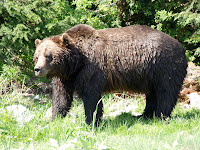
One day we had lunch with Kerrie and two of her friends from Australia. We went with them up to Grouse Mountain and watched the Lumberjack show, Birds of Prey show and a bear keeper talk. The weather was great and the bears were out foraging and swimming in their pen.

The next day we went in to Granville Island. We stopped for a while to watch one of the buskers, and then Paula, Bridget and Yolanda stayed to walk around the shops, while I rode around the Island and down to Jericho Beach and Kitsilano. It was a nice warm day, so there were lots of people out and about on the beaches. There was a beach volleyball competition, entertainment, and lots of boats out on the water.

After leaving the beach I rode over the Burrard Street Bridge, which has had an extra lane dedicated to bicycles. There were great views of Granville Island and the False Creek area, then around Stanley Park, over the Lion's Gate Bridge, and up Capilano Road to home. I was stuffed by the time I got home. Riding the bike up the hills here is great exercise, but not something I feel like doing everyday.
On Sunday we went to Cleveland Park for a picnic breakfast. After breakfast we walked down to the hatchery before heading home to pack. We then left late in the afternoon to head down to Washington to stay at Carol and Terry's house in Burlington.

Wednesday, July 22, 2009

Icefields Parkway

The scenery here is just stunning. You could stop the car on every bend to take a photograph. The mountains towering above you on both sides and following a series of lakes and rivers up the glacial carved valleys. The whole scene is a geography and geology lesson, with sandstone and shale belts that were once the ocean floor, that have been lifted with the violent upheavals in the earth's past history to now be 6,000 - 10,000 feet above sea level.

As we left Lake Louise the weather was overcast and there were intermittent showers. The weather seemed to clear slightly as we headed towards Jasper, some 230 kms along the Icefields Parkway. Along the way we stopped at most viewpoints, and finally stopped for some lunch at the Crowfoot Glacier. It looked like there was a possibility of a shower, and we had planned to cook some sausages, and eat like hotdogs. I got a small tarpaulin out of the car, and to the horror and embarrassment of Bridget and Daniel, began to tie it to the roof racks and set up poles and tent pegs, so that it looked like a makeshift annex. Someone even asked as they walked by if we were setting up a stall.
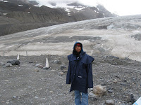
When we got to the Athabasca Glacier it was late in the afternoon and the breeze was quite cool. We put on jackets and walked up towards the toe of the glacier. It has receded more than 1.5 km in the past 125 years and lost over half of its volume. It currently recedes at a rate of 2-3 metres per year. That means that since we were last here in 2001, it has receded about 20 metres. We were able to walk on the toe of tha glacier last time we were here, but you are now prohibited from going on it because of the danger. It has formed a lake and a fast moving stream under the ice. At about the same time as we were her in 2001, a nine year old boy was walking one the glacier, and he fell down a crevasse. By the time the rescuers got him out, he was dead through exposure and hypothermia. The glacier is one of 6 main toes of the Columbian Icefields. Water melting from this icefield can end up in one of 3 oceans depending on which river it follows. The 3 main rivers are: the Columbia, which empties in to the Pacific ocean at the Oregon and Washington border; the Saskatchewan which heads to Lake Winnipeg and eventually Hudson's Bay and the Atlantic Ocean; and the Athabasca River which heads towards the Arctic Ocean.

The sun didn't set until after 10 pm. so there was plenty of light in the day to continue and stop at the waterfalls and other view points. One of the most exciting events was the sighting of a black bear foraging for food on the steep side of the road. It was about 50 metres up a slope and walking along parallel to the road.

We were a bit worried about whether we were going to be able to find a camping spot in Jasper, but luckily there was space in the Whistlers Campground just a few kms. short of Jasper. We set up camp, lit a fire, had dinner and ate S'mores around the fire.

The next day we packed up and headed in to Jasper. We spent time exploring the shops and replenished our food stores for lunch. We then headed towards Maligne Canyon and Lake, where the info guides suggest there are good chances of seeing local wildlife.

We stopped and explored Maligne Canyon, where the Maligne River has cut it's way through the rocks on it's journey from Maligne Lake to the Athabasca River. As we headed further up the valley we spotted two male elk. They had about 4 tines on each antler. We watched as they nibbled on trees and buushes along the side of the road, crossed the road, and continued until they disappeared into the bushes. A little bit further along the road we saw a couple of cars stopped. They were looking at another bear turning over rocks looking for food. Another photo opportunity, or as Daniel reminded us, that the rangers had mentioned at the ranger talk at Lake Louise, we shouldn't stop, and should minimise our contact with the wildlife because they will get too used to people, and can lead to danger - cars etc. On the return trip we saw a huge male elk with 7 tines on one antler, and 8 on the other.

We left Jasper at about 5 pm. and started to head for home. We took the Yellowhead Highway towards Revelstoke. Great scenery everywhere you look. We kept ssing signs to beware of moose for the next 15 km, or 20 km,. so we were on the lookout. We didn't see any. We did pass a wayside stop where we saw a bear walking through. We slowed and noticed that it was walking over to a small grassed area where there was another bear. They both began digging in the sandy grassed area obviously looking for food. We took some pictures and continued on our way. As it was getting towards sundown i noticed a shape on the side of the road ahead of us. It turned out to be a female moose walking along the side of the road towards us. As it got closer, it turned in to the bush and disappeared up the hill.

We started talking about where we would camp for the night and I started to see flashes of lightning all around. We decided not to camp, so we had a quick hamburger at the local DQ, and drove through the night getting home at around 3:00 am.

Friday, July 17, 2009

Rivers, lakes, mountains and glaciers

After a few days back in Vancouver, we headed off towards the Okanagan and the Canadian Rockies.

We took the road to the north of the Fraser River which took us through Mission and Harrison Hot Springs. On the way to mission we were stopped and advised that there gad been an accident on the road ahead and that there would be possible 30 - 45 minute delays. We decided to continue in this direction and have a look at the countryside rather than turn around and go another way. There were lots of farms along the way, all with crops, fruit and animals in the fields. The berry crops were all ready to harvest and there were stalls selling berries, cherries and other fruits and vegies along the route.

We pulled on to a side road to have a look at the berries. We stopped at one farm that had blueberries growing. As we were looking at the berries and taking photos there was a blast from what sounded like a shotgun nearby. A few minutes later there was another one. Looking around I realised that they had a setup to scare birds away. There was a large tube on top of what looked like a large sprinkler on stilts. Every now and then a blast came from the tube and it spun around to face a different direction. A few minutes later - another blast.

We bought some cherries and blueberries and continued on our way. There was one lane of the road open because they were still clearing up the mess. Apparently a train had hit a truck at a level crossing. Cleanup crews were still tidying up. The remnants of the truck had been lifted on to the back of another truck, and they were cleaning up the road.

We continued on towards Harrison Hot Springs. When we got there we realised that this was the weekend of their annual Art Festival. There were no suitable camping spots left in the town so we headed for Bridal Veil Falls.

At Bridal Veil Falls there were a couple of sites left, so we picked the best one and checked in. We had stayed in this campground back in 2001. They are close to a waterfall, have very good facilities and have a swimming pool. They also have a pretty good price to match, but we needed to camp somewhere. We pitched the ten, had dinner, and I walked to the waterfall. It was only about a 15 minute walk. The falling water created a bridal veil look over the rocks as it dropped to the bottom of the falls. It had been pretty dry recently, and most of the snow has melted, so there wasn't a lot of water falling. In the morning I packed up the tent while Paula, Bridget and Daniel went for a walk to the falls. We all then went for a swim in the pool before we left.

We stopped in Hope for a while and had a look at some of the wood carvings down the street, bought some groceries, and headed for Manning Park. The road followed the valleys of the rivers and creeks, and the scenery was amazing. I was constantly looking in different direction when I should have been watching the road. We ended up stopping whenever we could to take photos. We pulled in to a Provincial Park that was right beside the river. What I didn't realise was that this was at the Skagit River Trail Head. The Skagit River is the one that flows through Burlington and Mount Vernon on the way to Puget Sound. If we followed it, we could end up near our 2001 residence in Burlington. The water was crystal clear, a bit of a comparison to some of the Blue/green coloured lakes and rivers that were coloured with rock flour. As we were eating, chipmunks were darting about, getting whatever food they could find. The day was warm enough that I decided to have a dip in the river. It was quite cold, almost numbing on the toes, but very refreshing. Bridget decided to venture in as well, and once we were dry we continued on our trip.

We drove on to Princeton and found a campsite alongside a Similkameen River. We looked around the town, but almost everything was closed being a Sunday night. We woke again to another sunny day and I ventured into the river for a wake up splash. The rocks were quite slippery, and I wished I had some sort of footware on.

Okanagan Lake was our next destination. The environment was getting dryer, and the trees less dense and big. We arrived in Penticton on quite a warm day to find that most of the population must have been at the lake. Anyone who owned a boat must have had it out and on the lake. The beaches were covered with umbrellas, and there were people everywhere. We continued along to Okanagan Lake and found a beach along the shore for a swim and a picnic. There was evidence of fires along the shores in recent years, and the area was very dry. There were patches of green where fruit trees and vineyards were growing.

We continued north towards Shuswap Lake and ended up camping just out of Sicamous. The next day we headed towards Lake Louise. We travelled via Rogers Pass in Glacier National Park. The mountain scenery was breathtaking. From here the road went west towards Yoho National Park. We stopped at the ranger's station to get information about the area.

On the way to Lake Louise we stopped at the spiral railway tunnelsand happened to be around to see a goods train go through the tunnels. The goods trains are so long here that we could see the front of the train come out of the spiral, the middle of it entering the tunnel, and the tail of it on the track just below us. Amazing technology!

We continued on to Lake Louise and hoped that we would be able to get a tent site inthe campground. When we were there 7 years ago, we were not allowed to camp in the campground with tents because there was a mother grizzly, with 2 cubs in the area. This time we were able to get in on a cancellation, and the camp area was now surrounded by an electric fence. Instead of using one to keep animals in, this one was to keep the animals out. There was an electrified grate that you drove over to get in to the camping area, and fences encircled the camping area. There were gates with insulated handles that campers could use to leave the area and use that walking trails.

I woke the next day to an overcast sky. Unfortunately the others were not up before it started to rain so we waited for a break in the showers before we tried to pack the tent. We drove to the lake and walked around the shore to the canoe area. The clouds were down low over the peaks and there were intermittent showers. It was still a very picturesque scene.

We left Lake Louise and headed towards Jasper on the Icefields Parkway. On the way we stopped at the Crowsfoot Glacier. The scenery along this road is just stunning.

Friday, July 10, 2009

Wednesday, July 8, 2009

4th of July - US Independence Day

We got an invitation to go to Poulsbo for the 4th of July weekend. The invitation came from Kim and Rob, who were on exchange to Grafton, NSW in 2008. We also spent time with them back in June when we went to a Mariners game, and kayaking on Lake Union.

We arrived on Friday afternoon to find that the house was right on the shore of the Hood Canal. We looked straight up the canal to see the newly opened Hood Canal Bridge.

The local fireworks display in Poulsbo was set for Friday, July 3rd. We headed in to the harbour area, at about 8:30, to get a good position. There was a band playing and people setting up chairs and blankets in any good vantage position. We walked along the boardwalk and found a free position near the water. There were people on the boats that were moored, and some out on the ones in the canal. There were people rowing, and in kayaks, and the water police patrolling the canal making sure all watre craft had lights on and were clear of the fireworks barges.

The sun went down around 9:30 pm, but it didn't really start to get dark until after 10:00 pm. Boats started to toot their horns in anticipation. They started at about 10:15 pm and continued for about 15 minutes. Quite a good display.

The next day was July 4th and we drove in to Kingston to see the local parade. Again, everyone was getting there early to get the best position for a good view. We found our spot and waited for the parade to start. There were drum bands, cheerleaders, car clubs, motorcycle clubs and all kinds of community groups in the parade. Everyone was throwing candy to the crowd on both sides of the road. I think that we were probably lucky that we were near the start of the parade. The kids in our group were scrambling to get as much as they could. The parade route meant that the road through town was blocked, which also meant that access to the Kingston ferry was also blocked in both directions. On the way back after the parade we went to Port Gamble to have a look at this quaint village that had been built in the style of houses in Maine. There was an interesting shell museum, and we called in at an antique store as well.

During the afternoon we went to a nearby Indian Reservation to buy fireworks. The natives are allowed to sell fireworks on the reservation. We pulled up to a heap of stalls on the side of the road. There were about 20 stalls, but they all seemed to part of the same group. We pooled money and sent Richard of to barter and deal. Hayley was also excited to purchase her own pack. There were all sorts of fireworks available, and packs ranged from $20 to uver $500 for some of the super family packs. We must have driven away with a coupe of hundred dollars worth, that would just go up in smoke tonight. There would have been hundreds of thousands of dollars worth of fireworks sold through this outlet today.

After dinner there were some fireworks set off by the kids. We had a fire down on the beach and had set up a platform on the sand from which the fireworks would be launched. The official opening was when all the women were invited down to the fire to light a sparkler and declare the event open. We watched the fireworks around the canal and nearby, while we set our own off. They ranged from tanks that threw out showers of sparks, to skyrockets and mortars that exploded into showers of colour high in the sky. There were all sorts including bumblebees that spun as they launched and those that whistled as they flew. We began packing up around midnight, and still had some that could be packed up and used for next year.

The next day sitting out on the deck looking out over the canal we spotted a submarine being escorted from the base down the canal to the open sea. There were tugs with barges stacked with containers on either side of it in an attempt to shield it from public view. It was probably a nuclear sub and there were smaller navy boats in front and behind it making a "no-go zone" around the sub and the barges.

The Olympic Peninsular

We left Westport on Monday morning and headed around Gray's Harbour towards Ocean Shores. There is a passenger ferry that runs from Westport to Ocean Shores, which is only a few miles across the harbour, but to take the road trip it is about 45 miles (72 km), or 1.5 hours by car. We travelled around the harbour through Aberdeen and Hoquiam, and had lunch at the mouth to the harbour. It was quite a sunny day, but here was quite a breeze so we sheltered behind a rock groyne and had a picnic lunch.

After lunch we decided to drive north along the coast. We had only travelled a couple of miles when we saw a State Park. We turned in to explore. Most State Parks have camping facilities, and this was no exception. There was no ranger on duty, so we went in to find a vacant site and self-register. This was Ocean City State Park, and it was $19 for a tent site for the night, which we were supposed to put in an envelope and drop in the honesty box. We also made a mistake when we deposited a $20 note to get some 25c shower tokens. Unfortuneately the machine didn't give change, and like the slot machines at the casino, it began spitting out 80 shower tokens. One token gets you 3 minutes in the shower. We now had 4 hours worth of shower tokens that could not be refunded, or used in any other state. We decided to try and get rid of them roaming the campground to see if anyone needed any. We managed to sell about $15 worth before we left.

When we left on Tuesday we were headed for Forks. We turned off the main road to visit Quinault, which is on the shore of Lake Quinault in the Olympic National Forest. This valley is called "The Valley of the Giants" because there are 6 of the world's largest trees here. We stopped at the World's largest Sitka Spruce. They get quite a bit of rain in this part of Washington, and the rainforest conditions here are just right to produce these giants.

We then continued towards the coast again and stopped at Ruby Beach. The sky had been clear with the sun shining until we got to this part of the coast. Here the sea fog seemed to have descended and shrouded the coast in a grey mist. We got out of the car and began the walk down to the beach and the view of the mist covered seastacks, picking berries from the bushes along the way. As the beach came into view we could see some stacks in the water but it was hard to know what the view up the coast would be like because we could only see about 200m. After a walk along the beach to stretch our legs we haeded back to the car.

Forks was one place that Bridget really wanted to see, because this was the setting for the books that she had recently been reading - Stephenie Meyer's Twilight series. They also had film sets for the second book, in the forest just down the end of our street, back in May. The first thing we did when we got ot Forks was to pull in to the Information Bureau. There posters and other paraphenlia about Twilight in the windows, but the thing that got most attention was the red truck from the movie, or a replica. We drove in to town and had to drive by the high school. We also called in at a supermarket for supplies, and found Twilight souvenirs everywhere. There was also a mini-bus that was taking people around the town, and surrounding area to scenes used in the movie.

After filling up with gas (petrol), we headed for the La Push on the coast. La Push is on an Indian reservation on the coast. The beach was quite rocky, as was the RV park and campground. None of the campsites were particularly appealing, so we enjoyed the view of the sun setting behind Little James Island and headed for Moro State Park and campground, which was just across the river, but we had to head inland for about six miles to get to a bridge. The campground was pretty full, but we managed to find a reasonable site, and set the tent up for the night. This was in the conifer forest right next to the Quilayute River, and at the beach. The giant trees and berry bushes kept the campsites reasonably private, and you didn't realise how many camper there were in the park.

It was a sunny start to Wednesday and we packed the tent, loaded the bikes onto the rack and drove to the day car park for the beach and walking trails. We spent some time on the beach, and taking in the views of the islands and sea stacks along the coast. I walked along the stony beach towards a point and an island off the beach. There was a really nice beach at the end and along the way there were eagles watching for fish in the river.

We then drove back towards La Push and I suggested that we should stop and walk out to Second Beach. It was only a short walk from the road and the scenery was supposed to be worth the view. The scenery was great, but the walk was a little hilly and it took about 20 minutes each way. The beach was nice and sandy. We stayed for an hour or so, and then again headed north along the coast. We headed for Port Angeles, and had a beautiful scenic drive along the shore of Lake Crescent.

At Port Angeles we found a music performance on the pier at the beach. We stopped and bought Indian take-away food, which we ate at the pier. It was getting on towards 8:00 pm when we decided that we should leave and find a site to camp for the night. The sun doesn't set until about 9:30, so the time gets away from you. We drove to the Dungenesss State Park at the beginning of the Dungeness Spit. There were deer in the park and eagles roosting on the cliffs above the beach. It isn't often that you are able to look down on an eagle.

Great weather again so we decided to go into the Olympic National Park, and go up to Hurricane Ridge. On the way up I asked if anyone would be interested in riding bicycles down from the top. Bridget seemed to think that it could be fun, but Daniel was not interested. We had a picnic up at the top, wnadered around the Information Centre, listened to a ranger talk, watched a short movie, and then got ready to ride down the mountain. Hurricane Ridge is 5225 ft above sea level, and 17 miles (27 km) from Port Angeles. I wouldn't say that we actually pedalled much, it was downhill almost all the way. I think that I need to replace the back brake pads on my bike, because I had the brake on almost all the way down. Quite a thrill!! Bridget and I met Paula and Daniel back at the waterfront where we had eaten the previous night.

After loading the bikes onto the car we were again off looking for a campsite. We headed for Sequim Bay State Park, a distance of about 20 miles. We arrived just after 8:00 pm. and found a site down near the water. In a discussion with a guy from the next campsite, he mentioned that his grandkids had been down at the water disturbing it to see the plankton glow in the darkness. I had read abou this green glow in a book that one of my reading groups had done this past year, so Bridget and I went down to see this phenomena. We shook our hans around in the water, or stirred it with a stick and the plankton in the water gave off a greenish, neon type glow.

On Friday we headed for Poulsbo for 4th of July celebrations. On the way we stopped at Jamestown. I was attracted by the totem poles around the Cultural Centre. We walked around and learned about the S'Klallam Tribe. We also called in at the casino to have a look at the native art and the poles surrounding it. We had lunch at Port Townsend State Park and then headed for the Hood Canal Bridge to get to the Kitsap Peninsular.

Rusty Scupper Pirate Daze - Westport, WA, USA

Pirate days in WA, USA

It was at the staff breakfast, on the last day of school, that Erica mentioned that she was heading to a pirate festival and to go surfing, down in Westport, Washington. I thought that Bridget would like to hear about this, so when I got home, I checked out the details on the internet. The Rusty Scupper Pirate Daze was a 3 day festival with a parade on Sunday.

Westport is down on the west coast of the Olympic Peninsular, and we were going to Independence Day celebrations down at Poulsbo, on the Hood Canal on the 3rd of July, so this was in the same general direction.

We packed and left on Saturday morning, and as we crossed the border the Border Patrol officer was asking whether we had anything to declare, and who packed the car. I didn’t realize that Paula had packed three mandarins, and that he could see them, but I couldn’t. He said that, unless his eyes were deceiving him, there was fruit in the car and that it was a US$300 fine for making a false declaration. He kept our passports and directed us to get the car searched. We were told to leave the keys in the car and to go inside the Customs building. We were met by a female officer who asked what was in the car, and where it was. She put on gloves and went out to inspect the car. She opened the doors, and undid the straps and clips on the roof carrier to inspect. She found the fruit where we had said it was, but continued to inspect the rest of the car. When she came back in she said that the other border guard had said that I had not known the fruit was there, but that as the driver I was responsible. This time we would be let off with a warning. What a relief! We had been at the border for over an hour while this all unfolded, so we were finally glad when we could fix our load and be on our way.

We headed down I5 with all the other traffic towards Seattle. The closer we got the more the traffic. We continued past Seattle, Tacoma, and Olympia, and aimed for Aberdeen and the coast beyond.

When we arrived in Westport, on Gray's Harbour, we had a quick look at the festival area and left Bridget and Daniel to explore the stalls while we looked for a campground. The American Sunset RV Park was just on the outskirts of the town and had a good camping area. We left the bikes there and went back to find the kids. It was around 6:00 pm and most of the stalls were closing, so we walked around the town and then went back to set up the tent and organize dinner.

On Sunday we got organised to head in to the festival area, and for the parade that was to happen at noon. Bridget got dressed in the pirate gear that she had, and we rode bikes in to town. It was sunny with a good breeze for sailing. We locked our bikes up and joined the rest of the pirates.